Our rock stars on the Isle of Arran
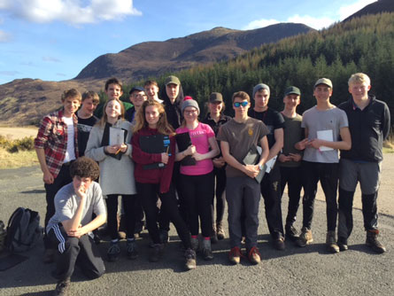
On 31st March, 16 Year 12 students and two members of staff set out to study the rocks and structures of the Isle of Arran. We flew from Heathrow and took a bus, train and ferry to reach our destination – then stayed at the Lochranza Field Studies Centre, which served as a home and base for the evening stud ies.
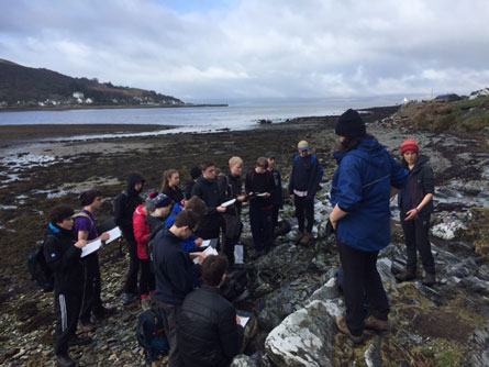 Day 1: the students studied the Cambrian metasediments of the Dalradian Supergroup in Lochranza Bay and saw how the Tertiary granite intrusions had influenced the topography of the area. They were able to apply their field techniques by using a compass clinometer to measure the dip and strike of the Geology, including the orientation of discordant dyke intrusions. They also applied their Cs and Ss and made sketches and recorded observations in their notebooks. The postgraduate leaders from the field centre were experts in the geology of Arran and led the fieldwork and the consolidation activities in the evening.
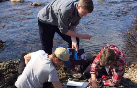
Day 2: observation of the Ordovician, Silurian and Devonian rocks in order to interpret palaeoenvironments of the region. Students were able to apply their problem-solving techniques in determining the cross-cutting relationships, and they constructed a rose diagram in the evening based on data collected in the field on the palaeocurrents of imbricate structures within the conglomerates.
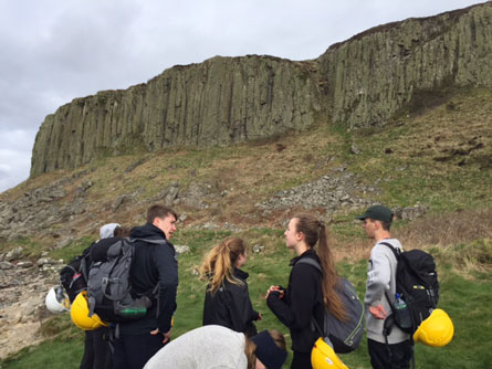
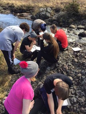 Day 3 saw the students walk the North Arran coast to observe the Carboniferous and Permian rocks. They collected data for a graphic log and followed an understanding of delta switching during the latter stages of the period. They saw the giant millipede trackway of Arthropleura (as visited by David Attenborough)and applied their geological knowledge in working out the reasons for the abandonment of a village in the 1700s, based on the extraction and abundance of salt and coal. The graphic log was constructed in the evening activities.
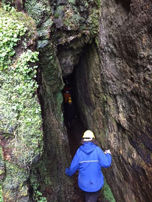 Day 4 saw the West of the island study area of Tormore to Blackwaterfoot which allowed the students to study the complexity of composite dykes through magmatic segregation as well as seeing a rare pitchstone intrusion and a beautiful normal fault at Kings Cave. (This, incidentally, was where Robert the Bruce came to hide after being defeated by the English until a spider showed him that if at first you don’t succeed try and try again!) The final and most dramatic exposure to end the trip was the magnificen t Drumadoon Sill, which is one of the largest exposures of a concordant intrusion with beautiful hexagonal columnar cooling joints. The students then worked into the evening byconstructing a map of the full geological history of the region and completed 10 years of past paper mapping questions in order to prepare them for their GL2 exam on their return after Easter.
 The Lochranza Field Studies Centre was a superb place to stay because as our group arrived, Newcastle University Students were there and, as we left, Aberdeen were just arriving with 60 of their 2nd year geological mappers – which provided a great opportunity to share knowledge and make contacts with other geologists.
Mrs Crossland and Mrs Finucane, Geology Department